

61-03. CHARTS
All questions: 190
In mode TRAINING show all questions of the discipline with correct answers presentation. To go to the next question, click the “Next”.
Questions for exams: 30
In mode Exam correct answers are not shown, after choosing the answer, transition to the next question occurs automatically.
1. (Refer to figure 061-12)
What is the radial and DME distance from CON VOR/DME (53″54,8’N 008″49,rW) to position 53°40’N 008°20’W)?

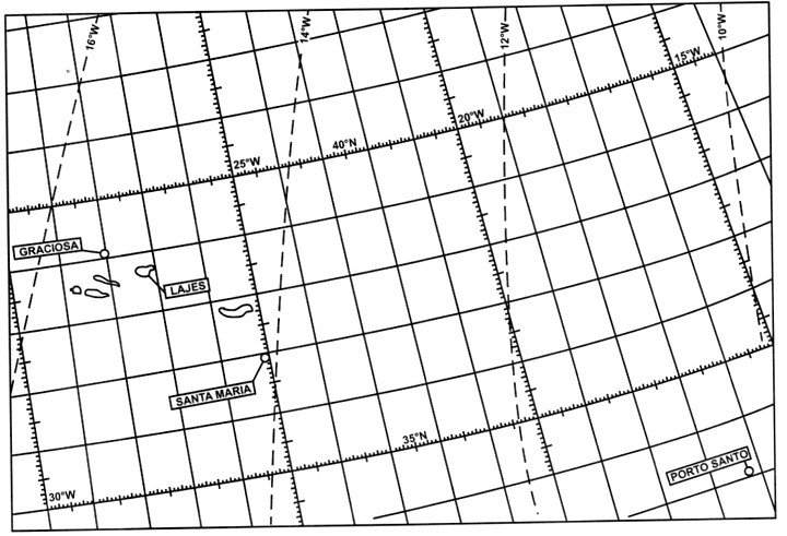
2. (Refer to figure 061-04)
At 1215 UTC LAJES VORTAC (38″46’N 027°05’W) RMI reads 178°, range 135 NM. Calculate the aircraft position at 1215 UTC:
3. (Refer to figure 061-12)
What is the average track (°M) and distance between CRN NDB (53°18,1’N 008°56,5’W) and WTD NDB (52°11,3’N 007°05,0’W)?
4. How does the scale vary in a direct Mercator chart?
5. (Refer to figure 061-08)
Which of the aeronautical chart symbols indicates a VOR /DME?


